




Lithops Distribution
General distribution and rainfall zones
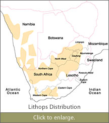
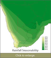
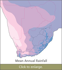
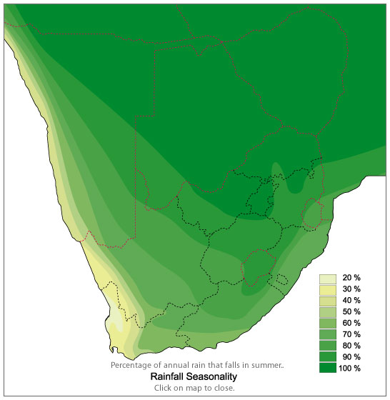
Above are three maps, the first one shows the general distribution of Lithops, the second shows the percentage of annual rainfall that falls in summer, and the third shows the average rainfall each of the areas receives annually. You can click on them to enlarge them.
Detailed distribution maps of the various species
For more information about the distribution of the various species, I have created a some maps with a lot more detail. These maps give a better idea of the distribution of the various species, and how their ranges often overlap with one another. The maps contain a lot of detail, and are in PDF format, so that you can zoom into certain areas to get a closer look. There are five different maps, all contained in one file.
Cole locality data
Most of the information available to us today regarding Lithops, was the result of the dedicated work done by Professor Desmond Cole and his wife Naureen Cole. Over the years they have visited many localities where Lithops grow, and these localities were all assigned what are known as Cole numbers. At each locality, they collected specimen plants, and seeds. These were all assigned codes, and many of the Lithops we now find in cultivation have these Cole numbers attached. The numbers give us information about the original spot that the plants in question come from, and I have compiled a list of these plants.